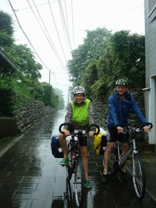
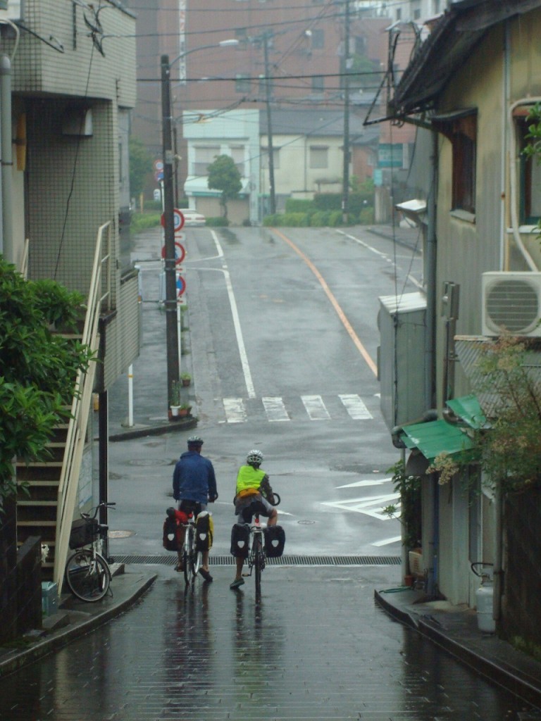
On 28 May 2011 and in pouring rain Jennifer and Machiel set out from Izumi on their epic journey to Kyoto. Enjoy Jennifer’s tour report !
Detailed Itinerary
Preparations
 We spent the next 2 days ironing out the details and buying flight tickets. On Friday we flew to Seoul, Korea and were met at the airport by our wonderful Servas host. “Wait a minute,” you say, “Korea? I thought you were going to Japan!” Yes well, we had managed to find a great guy who has started a business leading bike tours in Japan who was willing to rent us bikes starting in southern Japan (Kyushu) and ending further north in Kyoto. His business is called Japan Biking and you can find him on internet. Given that travel within Japan is pricey and we would be starting in the far south, we decided to fly to Korea and take a ferry over to southern Japan. This plan also allowed us to get a taste of Korea, which turned out to be quite an added bonus.
1st day in Japan
The tourist information women in Fukuoka were a bit shyer about speaking English than their Korean counterparts and much giggling ensued as one tried to give us directions to the nearest convenience shop where we would find breakfast and an ATM which accepted international cards (most bank ATMs didn’t). Off we went in the pouring rain, as the Japanese rainy season had officially begun several weeks earlier than usual. Luckily it wasn’t cold so getting soaked wasn’t really a problem. From the 7-eleven, we walked on into town to the train station, found out when the next departing train was that would take us south to Izumi (where we would rent the bikes), found a huge book store and bought the motorcycle touring atlas we’d heard was an excellent resource despite being in Japanese, ate lunch and caught the train to Izumi. Izumi is a small town so we weren’t worried about not finding Thomas, our bike rental man. However, finding him wasn’t as easy as we’d expected. We had his address and phone number so our first strategy was to look for a town map (our atlas wasn’t detailed enough for finding a specific address in a small town). This led us to the information desk and ended up engaging the woman who worked there and some other people who I’m not sure worked there but might have been friends or relatives but might also have just been fellow town citizens who happened to be at the train station at that time. Anyway, there was much phone calling (Thomas hadn’t answered his phone when we tried calling him directly as he was busy teaching an English class) and looking at a 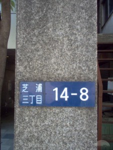 town map as the tourist information woman and another man tried to find out where Thomas lived. Addresses in Japan are not exactly straight forward as the numbers correspond not to a geographic location but to the order in which the buildings have been built. So even people who have lived in a town for a long time might find it difficult to locate a house just from its numerical address. In the end, they found someone on the phone who knew where Thomas lived, and the woman and man drove us in her car (thoroughly decorated with stuffed animals) to his house! We were, of course, incredibly impressed with this high level of assistance!
More preparations
We found Thomas just returning from his teaching lesson and he welcomed us into his house. He and his wife, Yuko, were incredibly hospitable especially considering she was due a week later to give birth and was in the midst of getting her driving license before the baby arrived. So it was not exactly a stress free time for them, but they shared delicious food with us and let us sleep in their spare room, thereby delaying our entry into the camping-in-the-rain life that was to ensue. We spent two nights with them, which gave us time to get ourselves and our bikes organized for 31 days of biking. We packed our bike bags and then sent a box with our backpacks and anything we didn’t think we needed while biking on to the man in Kyoto to whom we’d give the bikes in the end. I spent time copying down the detailed route information that was available on a website called Japan cycling navigator and a book that Thomas owned of the top 10 bike rides in Japan. Thomas gave us a tour of a supermarket so we had an idea of some things we could buy for easy camping food. Of course all this planning and packing took longer than expected and we didn’t actually set out until after lunch on May 28th. There was a typhoon moving through southern Japan, but western Kyushu was on the edge so this just meant that it was raining as we set out. We asked a passing mailman on motorbike to take a photo of us before we left. Thank you Thomas and Yuko!!
Ill prepared
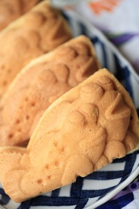 We were immediately soaking wet and with the wind from biking it was a bit chilly. Thus when we saw a woman waving to us and realized it was Yuko’s mother standing in her shop doorway waving for us to stop, we gladly did. And we even more gladly accepted her gift of filled pastries (what she sold in her shop) and towels, which she wrapped around our necks to help keep us warm. While we didn’t understand the words she was saying (she spoke only in Japanese to us), it was clear that she thought we were terribly ill-prepared for biking in such lousy weather and that we needed to be dressed more warmly. She was rather right. The towels helped a lot and proved to be quite useful throughout the trip. Thank you Yuko’s mom!!
Cultural contrasts
Our goal that day was to bike from Izumi to the island called Nagashima, which is connected to the mainland by bridge. Unfortunately we missed a turn off as the road we were supposed to turn onto had no signs at the intersection and we spent at least an extra hour trying to find the correct road. In the end we figured it out (with the help of some gas station attendants) and made it to the bridge at 6:00. Thomas had told us that there was a Dutch man living on this island and that the people at the local produce shop/traveler’s rest stop might know where he lived. We thought it might be interesting to meet a Dutch person living in Japan and perhaps he would be able to help us find shelter for the night. So we stopped at the shop and I went inside to enquire. Forty five minutes later we left the shop with a hand 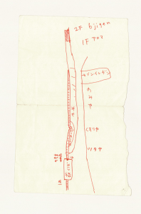 drawn map in hand of where to find this Dutch fellow. Getting the map had once again involved several phone calls and several people (the store employees, customers, and their friends who were called). The man who drew the map for us had driven down to the store and even offered to drive us to the Dutch man’s house but we declined as we wanted our bikes to also head in that direction. Another half hour down the road, the same man appeared again in his car to check on us and we assured him that we were ok and he told us we were half way there. We arrived in the village as it was starting to get dark, and there once again the map man appeared, this time with his wife in the car with him and the Dutch man in another car behind him. It seems he had taken it upon himself to go to the Dutch man’s house, knock on his door and tell him that friends of his were looking for him. Well, the Dutch man was Dutch and not Japanese and we were not his friends. He was civil enough and he did give us a car escort to the nearest hotel to show us where it was, but not until he had told the departing Japanese man (who up to this point was quite happy to have been able to help us find each other) that we were in fact not his friends. It was an interesting cultural contrast and we were sorry the Japanese man had spent so much time trying to help us (he did know that we didn’t know the Dutch man as I’d told him I didn’t know his name or anything about him other than that he lived on the island). After this we were somewhat more cautious about asking for help knowing that people would go above and beyond our expectations to help us. And while it was disappointing that the Dutch man wasn’t interested in socializing or helping us find cheap or free shelter for the night (the hotel he brought us to was nearly 3x our daily budget – so not an option for us), his reaction was a perfectly acceptable reaction according to western cultural norms. We left the hotel he’d brought us to and cycled a few kilometers further to find the campground marked on our atlas. There we found an unused cabin with a porch under which our tent fit perfectly. Thus we managed to stay dry despite the heavy rains that night.
Biking during the rainy season
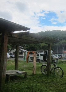 In the morning we headed north to the ferry terminal and found that the ferry wouldn’t start running until 14:00 due to the typhoon. While we waited the sun came out and we managed to dry all of our wet clothes and gear. That was quite a relief! Over the course of the 31 days we only got thoroughly soaked 4 times which we felt wasn’t bad considering it was the rainy season. In all cases, the sun came out after a day so we were able to dry off before things became moldy. It did rain a lot at night, but usually we had already set up the tent so that wasn’t a problem. We also managed to find a lot of roofs to pitch our tent under, which was especially nice in the morning if it was still raining.
Camping in Japan
We had read prior to setting out that it is perfectly acceptable to sleep in public spaces and our experience confirmed this. Before leaving Thomas and Yuko, Yuko kindly wrote out a polite letter in Japanese that introduced us and explained that we were looking for a place to put up a tent for the night. We used this on several occasions when we hadn’t been able to locate a place ourselves, and in all cases the person we showed the letter went out of their way to lead us to a spot they thought was acceptable for us to sleep. This often meant driving or even jogging ahead of us as we followed on our bikes. On a few occasions we continued on to find a different spot as we weren’t comfortable sleeping in the bus stop, train station or park with no toilet. Clean public toilets abound in Japan and we were always able to find a camping spot with a toilet nearby. The best spots 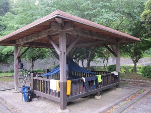 turned out to be parks with covered picnic areas. Our most unusual sleeping location occurred on one of the days we got soaked while biking, and it was still raining when it was time to set up the tent. I wasn’t interested in sleeping in a swamp and managed to convince Machiel that it was ok for us to sleep in the handicapped toilet cabin. It was spacious and clean. The only down side was that there was a motion detector on the light so every time one of us moved, the light came on. But it was a better night’s sleep than we would have gotten had we slept out in the rain and wind that continued on into the morning.
Our route
So over the course of 31 days we managed to bike approximately 1,500 km (932 miles).
We began in Izumi, biked through 4 islands off the west coast of Kyushu, biked east across Kyushu via the volcano Mt. Aso, and took a ferry from Oita over to another island, Shikoku. On Shikoku we biked a circular route south down to the southern most point and then back north to Matsoyama (still on the west 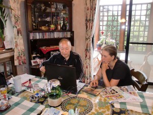 coast) where we took a ferry to Yanai, Honshu. In Yanai we had our only true (and much needed) rest day staying with wonderful Servas hosts who treated us to amazing food, gave me a “Go” lesson, took us for a visit to a historic bridge, and taught us about Japanese culture. It was amazing how much just one day revived our tired bodies. Thank you Masumi and Tomoyoshi!! We continued north to Hiroshima and then east to the beginning of a series of 7 bridges that led us back to Shikoku. On Shikoku we biked east along the northeast coast to Takamatsu where we took a ferry to the island, Shodoshima. There we were surprised to find the recommended route I’d gotten off the internet taking us up and over a high mountain with 18% grades. We managed it and saw some monkeys in the process. We then took a ferry to Himeji, Honshu where we visited the historic castle. From there we continued east to Kobe, Osaka, Nara and finally Kyoto. The final 4 days were extremely hot (getting to 35 degrees) which was harder to bike in than the earlier rainy days. We did get quite the bike tans though (complete with white strip on the side of my face where my helmet strap was), which we were rather proud of.
Roadkill
When biking one is much more in tune to road surfaces and roadkill is a part of the daily sensorial experience. Abandoned gloves were by far the most commonly seen roadkill. Luckily they didn’t smell or offend. Then came snakes, most of which were dead, but we did see a few live ones on the roads as well. Other roadkill were regional. So in one area there were many squished red crabs, whose defense mechanism was tragically outdated for modern predators such as cars and bikes. 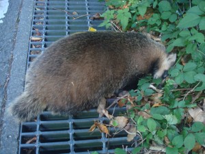 Another area was full of huge bloated frogs. After the rainy days, the thickest and longest black earthworms I’ve ever seen had met their demise. And a turtle and a mystery mammal that seemed to be a cross between a possum and a badger we saw only once. It was interesting to compare this to New Zealand where we mostly saw mammalian roadkill such as possums and hedgehogs.
Gifts
The beautiful countryside, quiet roads, free camping and interesting architecture made Japan a wonderful country to explore by bike. However, it was the people we met along the way that made our experience really special. Time and time again complete strangers offered us gifts including drinks, food, a frozen towel (to help keep cool), mosquito repellent, Japanese multi-purpose cloths, and pictures taken on a cell phone which were printed out at a convenience store – and then delivered as a surprise further down the road. I was humbled by their generosity and I hope some of this spirit has rubbed off on me!
Culinary notes
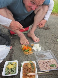 In addition, our homestays in Yanai and Chiba (outside Tokyo) gave us insight into Japanese culture (for example, amateur golfers take out “hole in one” insurance in case they get a hole in one and then are obliged to host a large party and distribute expensive gifts to guests) and an opportunity to taste a greater variety of amazing foods. If it weren’t for those homestays, I’m afraid our experience of Japanese food would have been limited to our daily routine of: rice, tofu, and yummy flavor packets containing spices and seaweed for breakfast; convenience store fare of ready cooked rice balls, egg, tofu, vegetables and noodles for lunch; and soba (buckwheat) noodles with assorted vegetables for dinner – hardly doing justice to Japanese cuisine, but economical and easy for us to cook on our little stove.
Garbage
Japan is a very clean country. So either the cute cartoony signs encouraging people not to litter are effective or somebody is cleaning up the roadsides and parks. I suspect, however, that people just don’t litter as much (we did see a bit) as the rest of the world. This is particularly interesting as trashcans are so rare. I believe we found trashcans in only 2 of the many parks we visited. There was, however, no shortage of receptacles for plastic bottles and cans. In fact next to every vending machine one could find them. On some days we carried our garbage with us for quite a while before finally finding a trashcan in which to deposit it. We eventually discovered that convenience stores and supermarkets often had trashcans, though these were often for separated recyclables and we were never quite sure if we were putting our garbage in the correct receptacle or disturbing the recycling efforts.
DETAILED ITINERARY
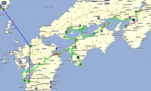 We began in Izumi, biked through 4 islands off the west coast of Kyushu, biked east across Kyushu via the volcano Mt. Aso, and took a ferry from Oita over to another island, Shikoku. On Shikoku we biked a circular route south down to the southern most point and then back north to Matsoyama (still on the west coast) where we took a ferry to Yanai, Honshu. We passed Kintai-kyo bridge in Iwakuni City. We continued north to Hiroshima and then east to the beginning of a series of 7 bridges that led us back to Shikoku. On Shikoku we biked east along the northeast coast to Takamatsu where we took a ferry to the island, Shodoshima. There we were surprised to find the recommended route I’d gotten off the internet taking us up and over a high mountain with 18% grades. We managed it and saw some monkeys in the process. We then took a ferry to Himeji, Honshu where we visited the historic castle. From there we continued east to Kobe, Osaka, Nara and finally Kyoto.
All map references are from the Touring Mapple Motorcycle Atlases (Kyushu and Shikoku/Southern Honshu). Approximately 1,500 km cycled in 31 days. All km statements are approximated from looking at the atlas.
Kyushu
Day 1: Started in Izumi (map 47) 367 to 378 to 389 (m46) cross bridge to Nagashima, campground with cabins and tent spaces across from beach (marked on m41 just 2km before ferry). Notes: no signs for turn off onto 378 from 367!! 378 is a small road and indistinguishable from other non-number small roads. If you get to a gas station you’ve gone to far. 30km.
 Day 2: (m41) ferry across to Amakusa, 35 north to 266 north to 389. Notes: Typhoon delayed our ferry departure several hours so a short day for biking. Really good/fresh sushi/maki rolls at tiny little shop (doesn’t look like a shop to untrained eyes) on the main street near side road leading to Sakitsu church! Tunnels were all ok to ride through though detours around them were also available. 25 km.
Day 3: (m41) coastal road from Sakitsu turning into small “purple”/scenic road marked on map. (m36) return to 389, camped in flower park way out on Reihoku peninsula – 324 out to the peninsula (park was just before the end of the road). Notes: Hilly day! A bit tricky staying on the “purple” road as more small roads exist than are shown on the map. This was especially true in the first few kms after coming down to the 1st harbor. Stay right of the lake. Also later along there was a flower park and it was unclear at the 3 way intersection which way was the “purple road”. We ended up going way down the hill to the park (thinking it was the “purple road”), which meant 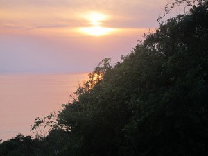 another hill to climb but it was a good place to eat lunch. Nice view/sunset from hill/lookout point in the flower park on Reihoku peninsula. Flying fish jumping in the water at the beach marked on map in Reihoku. Pretty sure there are showers available at this beach though we didn’t use them. 40km.
Day 4: (m36) 324 along coast all the way to Hondo, bridge over to next island (still Amakusa?), stayed on coastal road 324 and then kept to coastal route when 324 went slightly inland. Bridge over to Kamiamakusa. Camped at beach not marked on map at the far northwestern tip of tiny island between the big Amakusa/Kamiamakusa island and the little Kamiamakusa island. Notes: Camped at nice big beach with view of a tiny island that appeared to be accessible at low tide and someone was camped out there for the night. 60km.
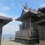 Day 5: Explored the little Kamiamakusa island but got a bit “lost” due to small roads not being marked on the map. 266 over to Uki island (m31). Welcome half day rest. Camped at a campground/beach marked on the map on Tobase island, a little island connected by bridge to the southern tip of Uki Peninsula. 30km.
Day 6: (m31) 266 east to 38 to what is marked 103 on map but in real life is signed as something else (I forget the number) to 239 to 443 to 28. (m25) east on 28 to the not numbered scenic road heading south again (yellow/purple road). Notes: Great little organic weekend café near where 1st camping is marked when heading south on the scenic road off of 28. Follow signs for camping left off the main road up and then down a hill. At the bottom of the hill go left. At 4 way fork intersection take the middle road and follow it around some bends and hills until you see small farm and sign on the left side of the road. Once you return to the main scenic road heading south and then east to Takamori there are very few (none that we saw) food shops/convenience stores. It is a long uphill ride (with a nice downhill bit towards the end) to Takamori so stock up on plenty of food along the 28 before beginning the next leg of the journey! 70km.

Day 7: (m32 and 33) Scenic route to 39 to 28 to Takamori (long uphill but then fun downhill with nice views too). Notes: No special biking map available at the train station in Takamori so perhaps take a digital photo of the map Thomas found there. 35km.
Day 8: (m26) 265 north to Aso city, 213 to 11 (m19) Notes: Aso city famous for soba noodles and special dance performances but we didn’t know this so didn’t look for either. Great campground at the intersection of 11 and 442 behind the rest stop/gas station. 50km.
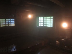 Day 9: Rest day visiting Kurokawa onsen. For onsen lovers, Kurokawa is perhaps the best destination of all Japan. Imagine a small village nested in the mountains of Kyushu, authentic ryokan with gorgeous outside baths, and guests walking from bath to bath wearing the traditional yukata. Notes: We got a “Bathing Pass,” and could then select three different rotemburo outdoor baths. Sanga Ryokan was fantastic !
Day 10: (m19) 442 to 669 to 30 (m20) to 618 to 210 all the way into Oita. Notes: Nice bike path along the river that 210 parallels so this would be a nice alternative route to the busy (and with minimal shoulder) 210. 618 and a bit of 30 detouring around a new tunnel were especially nice. 57km.
Day 11: (m20) 210 to bike path along the river to 197 (got on the bike path where 210 ended). 197 out to ferry terminal (m21) near the end of the peninsula. Ferry across to Shikoku. 34km.
Shikoku
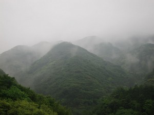 Day 11 continued: (m88 and m81) 197. Notes: Sadamisaki Hanto is a beautiful peninsula with citrus groves and steep hills. Our views were obstructed due to fog and rain but I’m sure it’s quite stunning when clear. Well worth exploring more. We saw a bit of the mini peninsula south of 197 (I/J 6 on the map). Slept at the campground marked on the map. 33km.
Day 12: (m81) 197 to Yawatahama, 25 south to (m88 and m89) 56 to 279 east to 31 south. Notes: Nice covered market in Yawatahama until 12:00. Big tunnel and 6 small tunnels on 56 don’t have bike path or shoulder. 279 is steep climb at end but pretty and leads right to interesting temple 42 on the pilgrimage route. 43km.
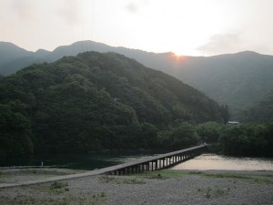 Day 13: (m89) 31 south to 283 east (met up here with the chinkabashi route described in the 10 best rides in Japan book) to Kihoku town. This part of our route took us across several special chinkabashi (sinking) bridges with no railings so that when the river floods the railings won’t be washed out. 381 to Matsuno. 8 south (m93). 381/441 south but cross over to right river bank at the first chinkabashi bridge, past youth hostel and then back to left river bank at 2nd bridge after the youth hostel. Notes: Visited temple 41 – location not clearly shown on map but there are signs and pilgrims to follow – could be missed. Internet in train station in Matsuno. 8 was a lovely quiet road mostly level/downhill. Bridges along 381 were fun. Local road past youth hostel was very hilly but fun. Youth hostel seemed an interesting place with kayak rentals and handmade canoes. Great campsite at the rest stop (just park and toilet – no shop) just before the small tunnel( K5 on the map – marked as a purple half circle) – access down to the river. We didn’t find the campsite marked on the map. 60km.
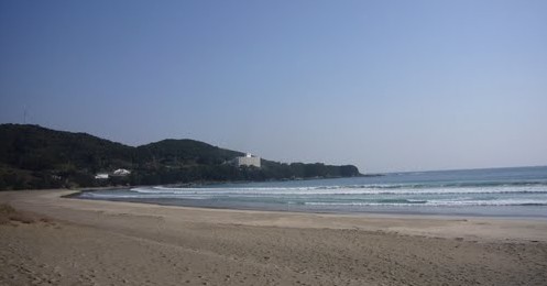 Day 14: (m93) continued south on 441 with small section on right river bank to 340 (m94) and then returned to right river bank local road past Shimanto, (m96) to 342 which becomes 321. Notes: Internet in city hall library in Shimanto. (m96 – C6) has a very nice beach. We intended to turn off of 321 onto 27 to go around the peninsula but we missed the turn off as there was no sign for 27. Instead we ended up in the big town (m96 – C7) on the southern side of the peninsula. The next day we biked around the peninsula in the opposite direction than originally planned which worked out fine. 27 is a fun little road. 55km.
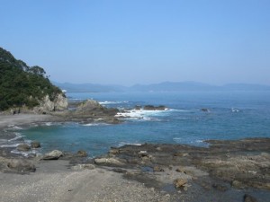 Day 15: (m96 and m97) 27 around the peninsula, temple 38, continued west on 321, camping at park before the camping that is marked on the map in H4 (we camped in I4). Notes: Onsen foot bath overlooking granite cave. Temple 38 was interesting. We didn’t explore the park near temple 38 but there seemed to be some nice trails and good for walks. Two interesting pilgrim resthouses along 27. The park where we camped was by a protected harbor and was the entrance point for an interesting shore walk along crazy sandstone rocks – highly recommended walk. I think the park also had signs for a marine park or aquarium and shell gallery of some kind. 45km.
 Day 16: (m97) 321 to 28 to 321 (m95) to 56. Notes: Beginning of 56 and tunnel had little space for bikes. Great Japanese pizza (and interesting owners) at resthouse (m95 – H3). It was the restaurant closest to the path to the toilets. Fun experience! He has a compass rose painted on the concrete outside the restaurant pointing to different countries. Couldn’t find the camping spot marked on the map (m95 – D2 ) though we thought it was an official campground and maybe it was just the sports park we found. We slept under the stadium outer walls. 50km.
Day 17: (m97 and m93) 56 to 287 to 56 (m89) through Uwajima and continued north. Notes: The detour on 287 around the peninsula was very hilly and not really worth the detour. We did get to see people working on pearl farms though. The official route also included a detour around the next peninsula on the 37 but we decided to skip that and just keep going on the 56. Internet available at the ferry terminal tourist info in Uwajima. 63km.
Day 18: (m89 and m82) 56 to Ozu. Machiel went 24 to 378 to (m75) Iyo. I went 56 to Uchiko to (m75) 378 Iyo. Notes: The castle in Ozu was interesting architecture. June-Sept there is evening cormorant fishing on the river in Ozu (we didn’t see it as hadn’t planned on being there in the evening) which would be cool to see. 56 was a busy road in most places and we got tired of biking on it. Machiel enjoyed the easy route to the coast and up the coast. I enjoyed the gradual incline up to the mountain pass after Uchiko and then the long downhill ride into Iyo. 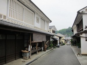 Uchiko was worth a visit. Little (and free) museum about tools and traditional building methods was worth a look. The old theater was also interesting though not free. Really interesting and tasty ice cream at the local foods shop/rest stop in Uchiko (m82 – F4). They had many different flavors like pumpkin and sweet potato and gave free tastings to help you make a choice. 77km.
Day 19: (m75) 378 to 23 to 40 to temple 48 to temple 50 (missed temple 49 somehow) to temple 51. 187 west into downtown, past historic Dogo onsen, to 437 out to ferry terminal. Ferry to Yanai, Honsho (m67). Notes: Temple 51 shouldn’t be missed. Temple 49 wasn’t interesting. Temple 48 was ok but could also be skipped. Historic Dogo onsen was a fun experience and beautiful building. 30km.
Honshu
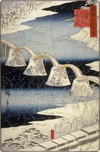 Day 20: Rest day in Yanai and sightseeing with our Servas hosts in Iwakuni City – Kintai-kyo bridge. Notes: The bridge was built in 1673, spanning the beautiful Nishiki River in a series of five wooden arches, and the bridge is located on the foot of Mt.Yokoyama, at the top of which lies Iwakuni Castle. For nearly three hundred years the many versions of the bridge stood without the use of metal nails. They achieved this by careful fitting of the wooden parts and by building up thick girders by clamping and binding them together with metal belts. The main wooden parts of the bridge would then be covered by sheets of copper. There are nails in the bridge now but it is still impressive : ) There is cormorant fishing also in Iwakuni City in the evenings.
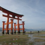 Day 21: (m67) 188 north (m55) to 2 to ferry out to Miyajima island, famous for the Itsukushima Shrine and the red torii gate. The island is a UNESCO World Heritage Site and one of Hayashi Razan’s (林羅山) Three Views of Japan (日本三景 Nihon Sankei). Continued on 2 (m43) to outskirts of Hiroshima (Saeki). Notes: Easy ride. Sat. morning early has much less traffic : ) 65km.
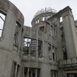 Day 22: (m43 and m99) 2 to 54 that goes right to Hiroshima peace park. (m44) 2 to 34 (m56) to Yasuura. 185 to (m57) Takehara. Notes: 34 had no shoulder and was uncomfortably busy at times. Takehara has some lovely old houses and worth a look. We camped at a great park just past the town. It’s the Takehara park (m57 – B½). 77km.
Day 23: (m57 and m45) 185 to 2 to Onomichi. Bridge over to Mukaishima. Recommended (and clearly marked) blue line bike path around islands and over the bridges to (m57) Innoshima, Ikuchijima and Oomishima. Notes: Great direct shortcut out of the park through village and down to 185. Onomichi train station has helpful tourist information. Can buy payment coupons for all of the bridges here. Also they have good tourist maps and maybe the cycling map also (though maybe the people we met who had this got it from the bike rental shop). Neat temple up a few stairs at intersection where the in-town road along the coast meets back up with the 2. First bridge from Onomichi to Mukaishima doesn’t have a designated bike lane but it was fine to ride on the shoulder. Yummy ice cream on Ikuchijima (m57 – H1) at roadside gelato/café. The bridge to Oomishima is called Tatara bridge and has a spot to listen to the flutter echo created by provided sticks stored in the railing. Great campground marked on map just under Oomishima bridge (m57 – F3). Blue line route is a great bikepath. 70km.
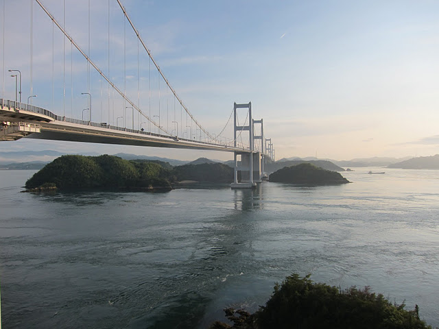 Day 24: 51 north to shrine located near intersection with 21. 21 back across island and blue line bike path down to bridge to Hakatajima. Bridge to Ooshima. 317 to mega bridge over to Shikoku (m69) and on to Imabari. 38 to 196. Notes: Shrine was pretty with nice big trees but it might be easiest/shorter just to take 21 across and back again if one wants to visit this shrine. Bike paths parallel but separated from the roads 51 and 21 make uphill gradients easier but are lousy for the downhill stretches. Great doing the route in this direction as this last bridge was a lovely finale. Good camping at beach marked on the map (m69 – 5F). 60km.
Shikoku
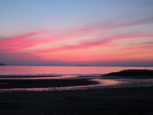 Day 25: (m69) 196 to 13 (m70) to 11 to Kanonji. Notes: 196 and 13 were especially busy with many trucks and few useable bikepaths. Great camping/beach with lovely sunset as marked on map (m70 – L2). 63km.
Day 26: (m70) 377 (m71 and m59) to Kotahira and Sanuki Konpira-san Shrine. To 32 to 172 to ferry terminal (m47). Ferry to Tonosho, Shodoshima. Notes: Ate Udon noodles in Kotahira. Shrine does indeed have many steps but was cool in the shade and nice views over valley. Didn’t find a specific cycle path into Takamatsu as is mentioned in cycle navigator route description. Probably better to take 11 into Takamatsu as 172 was up a big hill. 57km.
Shodoshima
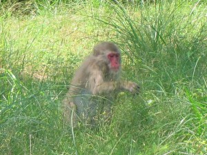 Day 27: (m48) 26 to 27 to 29 to 436 north to Yoshida. Notes: This was the route recommended in Japan cycling navigator. The route climbs up a big mountain with portions being 18% grade. There were lots of monkeys at the top of the mountain at the lookout point so that was fun to see, but otherwise the views were not worth the climb. It was a great physical challenge though and nice to have some biking through nature on a mostly very quiet and shady road. So we have mixed feelings if we would recommend it to others. The route description says it goes through a canyon but this was misleading as the road itself doesn’t go through the canyon (there’s a cable car trip that maybe does go over the canyon) and I think that their definition of canyon is slightly different from ours. There was a restaurant and ice cream place at the top, which was a good stop for lunch. 436 north to Yoshida was a good route – nice new tunnel. Several camping options in Yoshida – we camped down by the beach. This whole island had few signs in English for the tourist sites so there may be other interesting things to explore on the island that we didn’t know about. 52km.
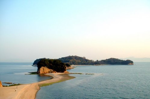 Day 28: (m48) Ferry across to Himeji from Fukuda. Notes: Ferry lands in Himeji at a different location than is marked on the map. Check at the ferry terminals to get an accurate map location.
Honshu
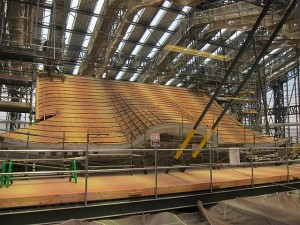 Day 28 continued: (m37 and m26) 62 right up to castle. Visit to the castle, currently being renovated. The renovation ended up being a cool thing as they had reconstruction info and special viewing platforms. 2 over Ichikawa river. South on 312, under railroad tracks and pick up bike path going southeast here OR continue a bit further on 2 and cross another smaller river and turn right on 399 (road just before 2 passes under the motorway). This will also take you to the bike path along the railway lines. Bike path to Akashi (m37 and m38). 2 towards Osaka.
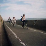
Notes: We had trouble finding the bike path from Himeji to Akashi as it is not described accurately in the cycle navigator route description. The above description is the correct route. Great path (though bumpy) following along raised railway line, which provides welcome shade on hot sunny days. 55km.
Day 29: (m38) 2 all the way in to Kobe and on to Osaka (m39) to 13/308 (308 seems to be the number of the road following under the raised motorway 13 but it is difficult to see this on the map and there weren’t many signs marking 308 – just follow the motorway. North on 170 to 8 east. 8 turns into 1 to Nara. Notes: This was our longest and in the end craziest day. Biking on 2 was surprisingly fine. Osaka was also fine to bike through. Lots of slower sidewalk riding, but the sidewalk was generally big enough for bikes. 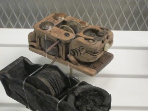 Carpentry Tools museum in Kobe was well presented and with info in English (can get info on the internet about it) – recommended for people with interest in architechture/building. This route takes you right past Osaka castle, which is a nice rest spot. After Osaka we ran into difficulty getting to Nara – our end destination for the day. We didn’t realize from the cycle navigator route description that 308 after Higashiosaka goes straight up a very steep mountain and is a very narrow road. We started out trying this route and then realized it was impossible in the dark after an already long day (but it would be immensely challenging any time of day) and turned around to complete the route described above. However the 8 and 1 are also absolutely NOT recommended for biking as they are fast motorways with no shoulder to speak of! So, another route from Osaka to Nara needs to be investigated. We suspect the best route is to head south on 170 to 25 and then north on 168. 83km.
Day 30: (off our Shikoku/southern Honshu atlas so took a photo of the relevant pages at a book store)
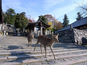 Sightseeing in Nara in the morning. Bike path from Nara to Kyoto. Camped along the river in Kyoto. Notes: Description of how to find the Nara-Kyoto (though it’s called something else) bike path on Kanko Cycling website isn’t very helpful as it is more ranting than useful info and it describes the route in the opposite direction. We had no problem finding the beginning of the path on the Nara side by locating it on the relevant Mapple atlas (dotted green line). 52km.
Day 31: Sightseeing in Kyoto. Night bus to Tokyo.
Jennifer

